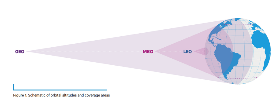
Satellites serve as essential components of our global infrastructure, facilitating communication, navigation and Earth observation as well as many other commercial and governmental uses. The four main types of satellite each play specific roles and have their own distinct characteristics:
| LEO (Low Earth Orbit) | GEO (Geostationary Earth Orbit) | MEO (Medium Earth Orbit) | HAPS (High Altitude Platform Stations) | |
|---|---|---|---|---|
| Altitude | 500 to 2,000 km above Earth. | Approximately 36,000 km above Earth. | Between 2,000 and 36,000 km above Earth. | Operate at altitudes typically between 20 to 50 km above Earth. |
| Orbit Characteristics | Satellites in LEO circle the Earth quickly, typically every 90 to 120 minutes. | Satellites in GEO match the Earth's rotation, appearing stationary relative to a fixed point on the ground. | Satellites in MEO have longer orbital periods than LEO but shorter than GEO, typically used for navigation and some communication services. | These are not satellites in the traditional sense but rather airships or drones that can provide coverage over a specific area. |
| Use Cases | Ideal for applications requiring low latency, such as broadband internet, Earth observation, and remote sensing. | Commonly used for telecommunications, broadcasting, and weather monitoring due to their consistent coverage. | Commonly used for global navigation satellite systems (“GNSS”) like GPS. | Used for communication, surveillance, and environmental monitoring, offering low latency and localised coverage. |
| Examples | Starlink, OneWeb, and the International Space Station. | Intelsat, SES, and weather satellites like GOES. | GPS satellites and O3b. | Google's Project Loon (now defunct) and AeroVironment. |


